

Pix4D: Strategic-Technological Analysis for European Defense and Dual-Use Autonomy
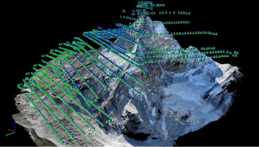
A Swiss startup founded in 2011, Pix4D has quietly become a leader in drone-based photogrammetry. Emerging from an EPFL computer-vision lab, Pix4D’s software turns thousands of aerial images into 3D maps with survey-grade accuracy[1][2]. In one test its team flew drones for under six hours to snap 2,188 pictures of the Matterhorn, then computed a 300-million-point 3D model of the terrain[2]. Such European-developed capabilities – hosted on EU-based cloud servers[3] – are of growing interest to defense planners who wish to replace foreign mapping tools. Pix4D’s photogrammetry suite supports civil and security use cases, from infrastructure inspection to emergency response, hinting at how it could bolster NATO’s mapping and reconnaissance needs. At the same time, its Swiss/Parrot ownership and EU-focused data practices suggest it can reduce strategic dependencies on non‑allied technology (for example by avoiding Chinese software backdoors[3]). The analysis below examines Pix4D’s legal status, tech portfolio and readiness, partnerships, and overall contribution to European strategic autonomy and deterrence.